


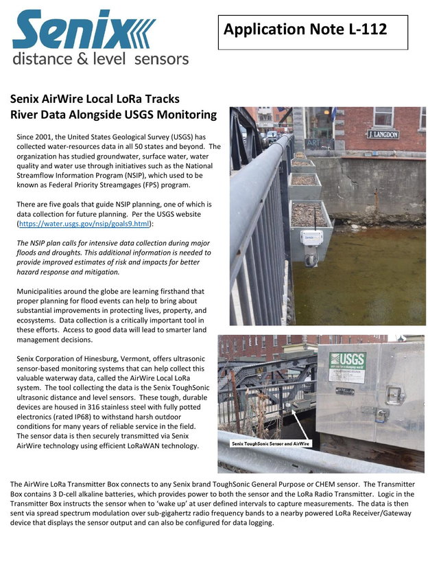
Content Summary
Almost one year into the program, we have seen consistent results showing that the Senix system provides the same level of data accuracy as the USGS. Variance of less than .25 inches were noted on occasion, which can be attributed to the lack of synchronization of when readings were recorded in the two systems and natural diurnal temperature changes that can affect the speed of sound.
As you can see from the following graphs, the displayed values plot the same data.
Access this content
Choose an option below
Your content has been opened.
Register to access this content
Verify your email to access this content
Code sent. Enter it in the modal
Your content has been opened.
Why do I need to verify I’m human?
Please verify you are a human before opening this content.
Your content has been opened.
The content will open in a new window. You may need to allow popups for this site.
Check your inbox
Senix AirWire Tracks USGS River Data has been emailed to . Entered the wrong email?
Don't see the content in your inbox?
Make sure to check your spam and other messages folders.
Can't get to your email right now?
By accessing content on the Water & Wastewater News Online Directory you agree to our Terms of Service and Privacy Policy; and, you acknowledge that your information may be shared with the content publisher.
You might also be interested in
Transport Series Brochure
Transport Series Brochure from Garnet Instruments highlights specialized solutions for liquid transport industries, focusing on safety, reliability, and precision. It details...
Read More
Unison Solutions Purchase Terms & Conditions
Our Purchase Terms and Conditions outline the foundation for conducting business with Unison Solutions, ensuring clarity and consistency in all transactions. We prioritize timely...
Read More