

Product Overview
SmartRain™
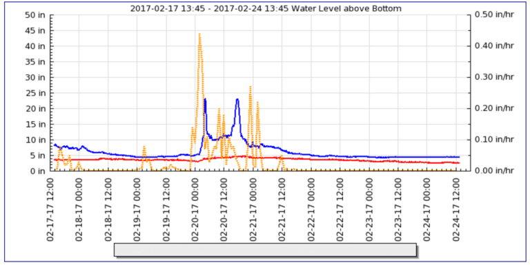
Rain data can be acquired from any desired location and presented in the user interface along with level or flow data in a single display (Figure 1 below). Data integration creates an easy method to view and understand the relationship of collection system level or flow changes as affected by rain.
SmartRain™ gauge location is determined by simply specifying latitude and longitude of the desired site. NOAA radar, combined and calibrated with ground-truth physical rain gauges, provides near-real time rainfall rates at the specified location. Locating multiple rain monitoring sites in a given sewer shed reveals “cause and effect” relationships in the basin. A “rain-field” using a grid of rain monitoring sites is easily deployed, enabling local variability of rain events to be captured. This can show timing and location of I&I at various SmartLevel™ monitoring points in your collection system.
No reviews yet. Be the first to share your experience.
Help others choose confidently by sharing your feedback.